Searchable Locations
Help visitors find stages, vendors, attractions, and services.
Interactive Maps
Bring your grounds, venues, and destinations to life with searchable locations, custom map artwork, and details that connect visitors to everything around them.
Practical map tools
Available tools vary by map type and app package, so Grandstand can help you select the right combination for your experience.
Help visitors find stages, vendors, attractions, and services.
Let visitors choose which types of places appear on the map.
Use illustrated grounds or venue artwork to reflect the space and its identity.
Bring descriptions, links, vendor information, and related content into the location experience.
Help visitors save supported places and find their favorites on the map.
Give visitors different ways to browse supported location content.
Map formats
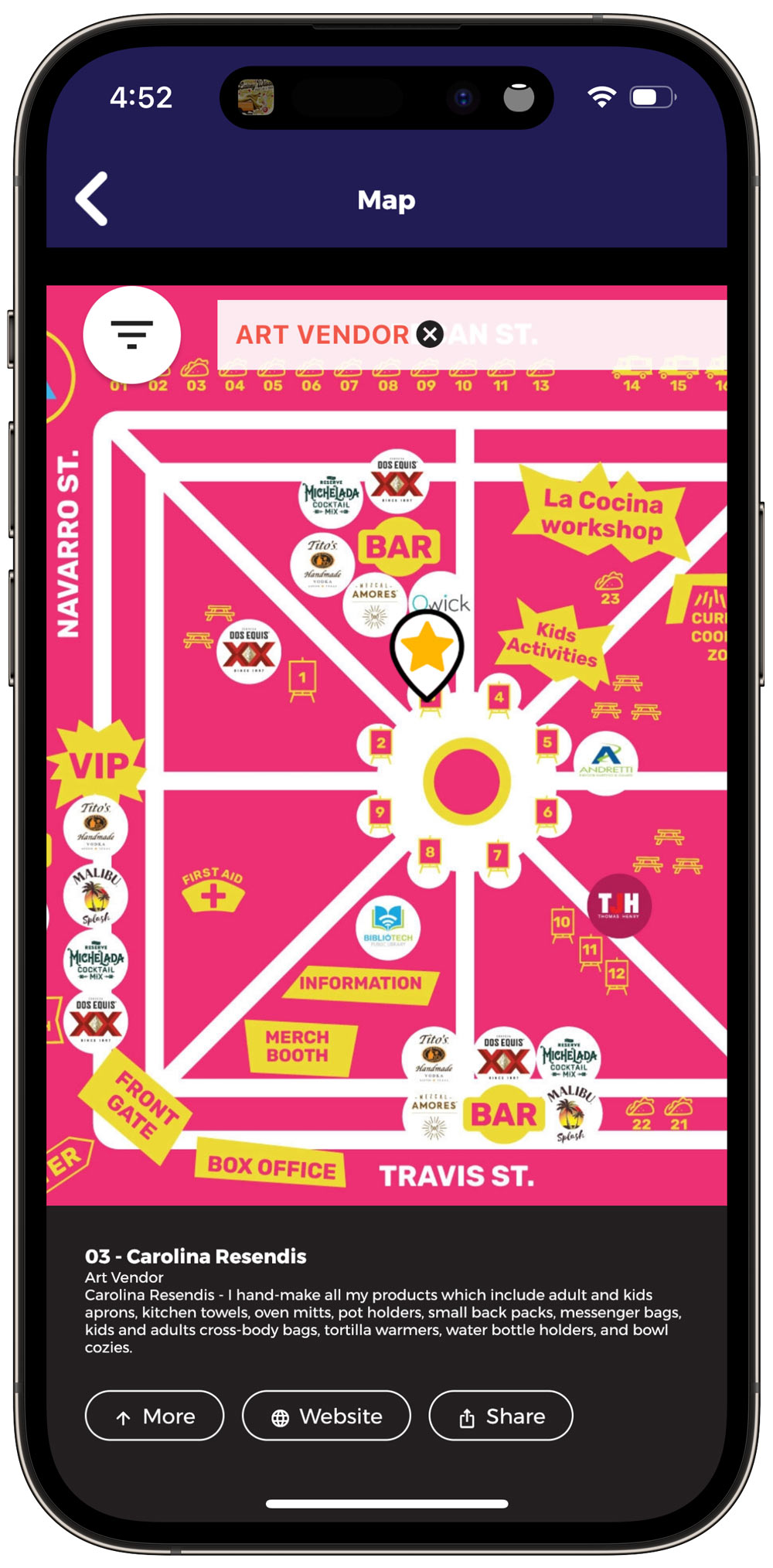
Choose a familiar geographic view, use recognizable site artwork, or combine custom artwork with a geographic foundation where supported.
Connected location details
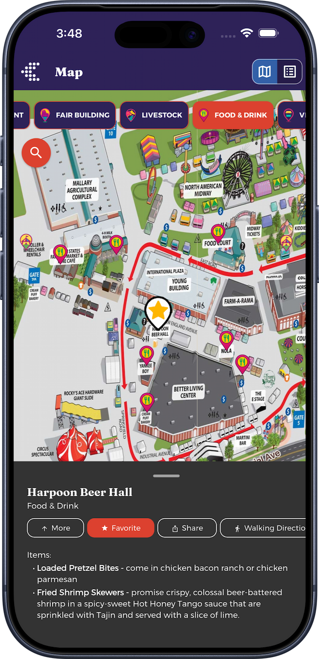
Once a visitor selects a configured location, the map can lead to the information that helps them decide what to do next. The Big E example shows a food location name and category, item descriptions, more information, a Favorite action, sharing, and an action that opens walking directions.
Directions connect visitors with a supported directions experience; Grandstand does not claim proprietary turn-by-turn routing, indoor navigation, or accessible-route planning.
Search and browse
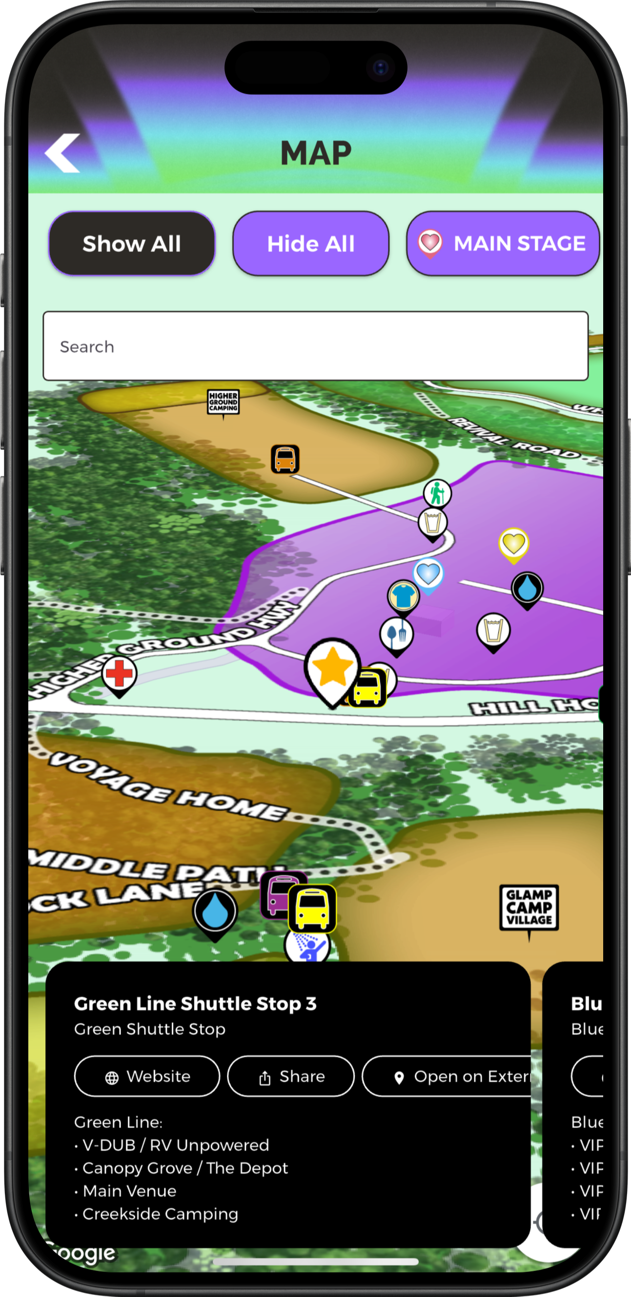
Supported configurations can let visitors show or hide categories, use Show All and Hide All controls, search configured locations, recognize custom icons or pin styles, and move between map and list views.
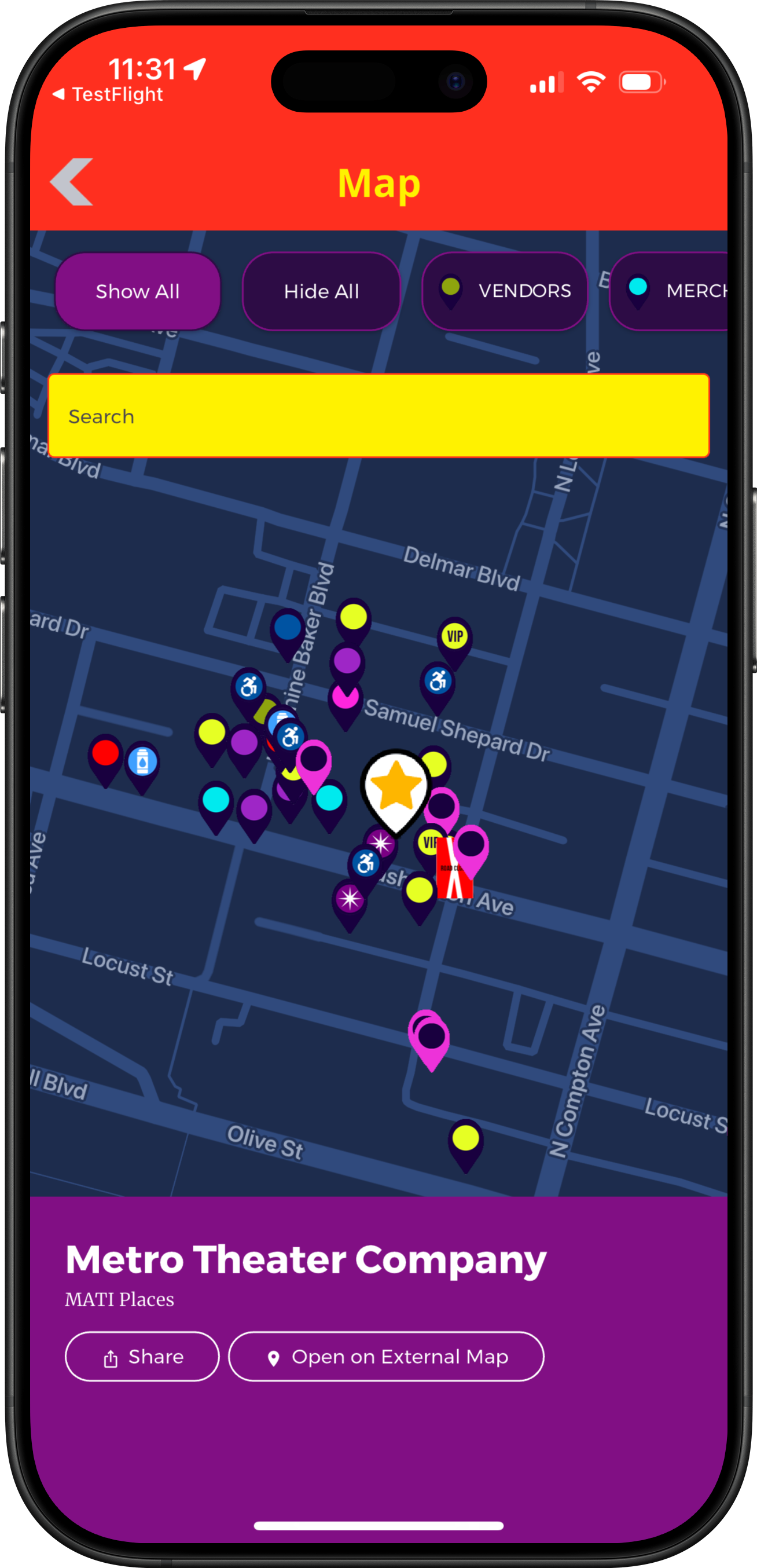
The Music at the Intersection example preserves the interface exactly as captured, including its TestFlight label. Map search works with configured location content; it is not described as natural-language search.
Favorites and schedules
Where supported by the selected package and content type, visitors can favorite places or vendors, filter a map to supported favorites, and view upcoming or live activities associated with a venue. Configured connections help people move between a location, its vendor information, and relevant schedule details.
Explore Event Schedules & FavoritesA location can be more than a pin. It can provide the useful context already maintained in your app without treating a pin style—or a star-shaped icon—as proof that a place has been saved.
Multiple areas
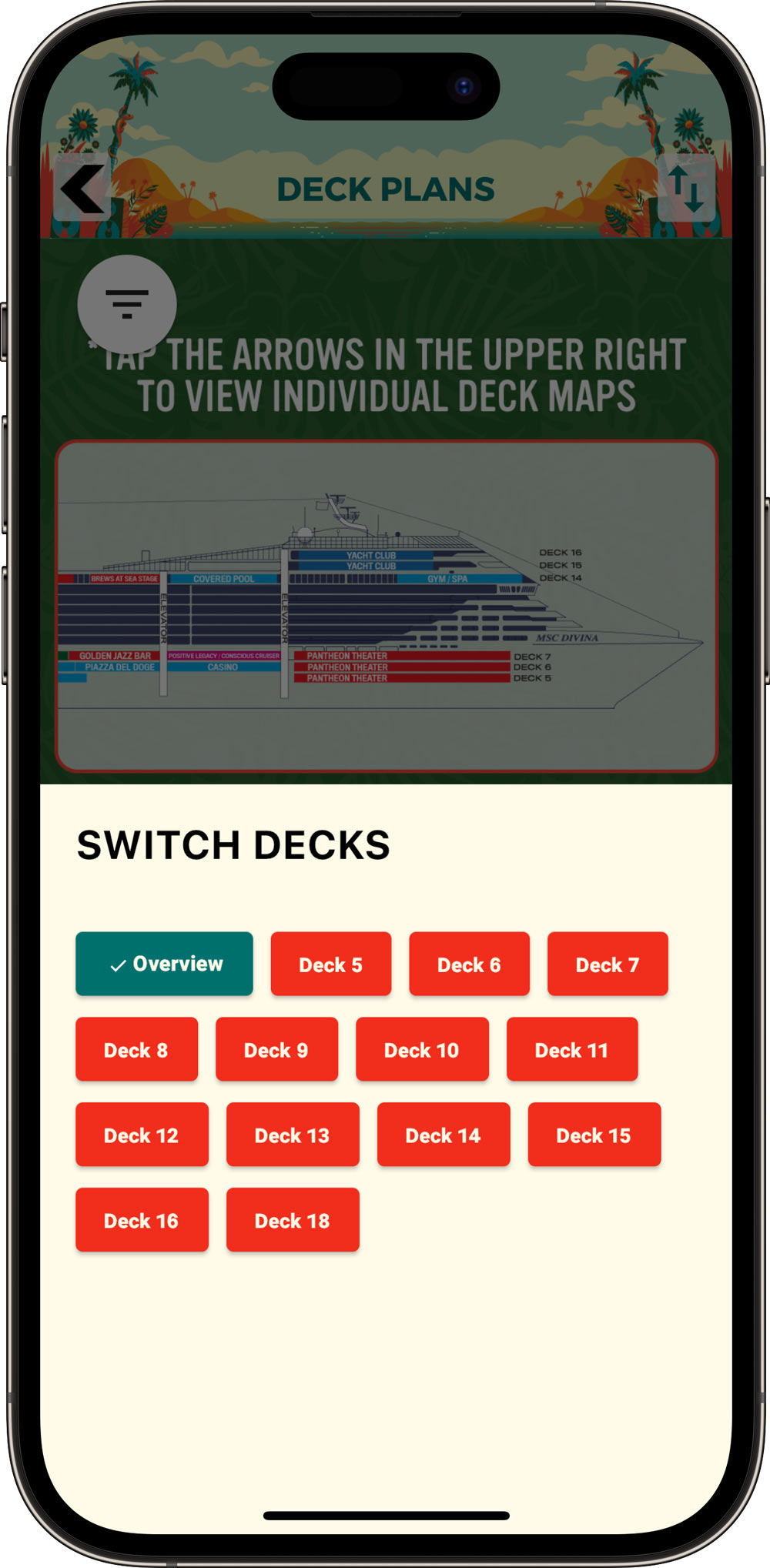
The Holy Ship example shows an open selector that lets participants switch between an overview and individual deck maps while the background is dimmed. Separate maps can help organize a complex venue without implying automatic floor detection, indoor GPS positioning, or navigation between decks.
Organizer tools
Manage location information: Maintain configured locations, categories, descriptions, and supported links through Grandstand’s browser-based tools.
Connect relevant content: Relate mapped places to the app information visitors need, including supported listings and activities.
Get map setup help: Assistance with map artwork and configuration is available where offered. Updating location data does not automatically redraw underlying illustrated artwork.
Custom artwork, overlays, and setup assistance may involve additional fees based on the selected package and project scope.
Map Web Widgets
Grandstand offers map widgets for existing websites, with supported content managed through Grandstand. Website widget behavior and available interactions may differ from a native-app map.
Additional offering: Web Widgets have their own pricing and are not included automatically with every app map.
Explore Web Widgets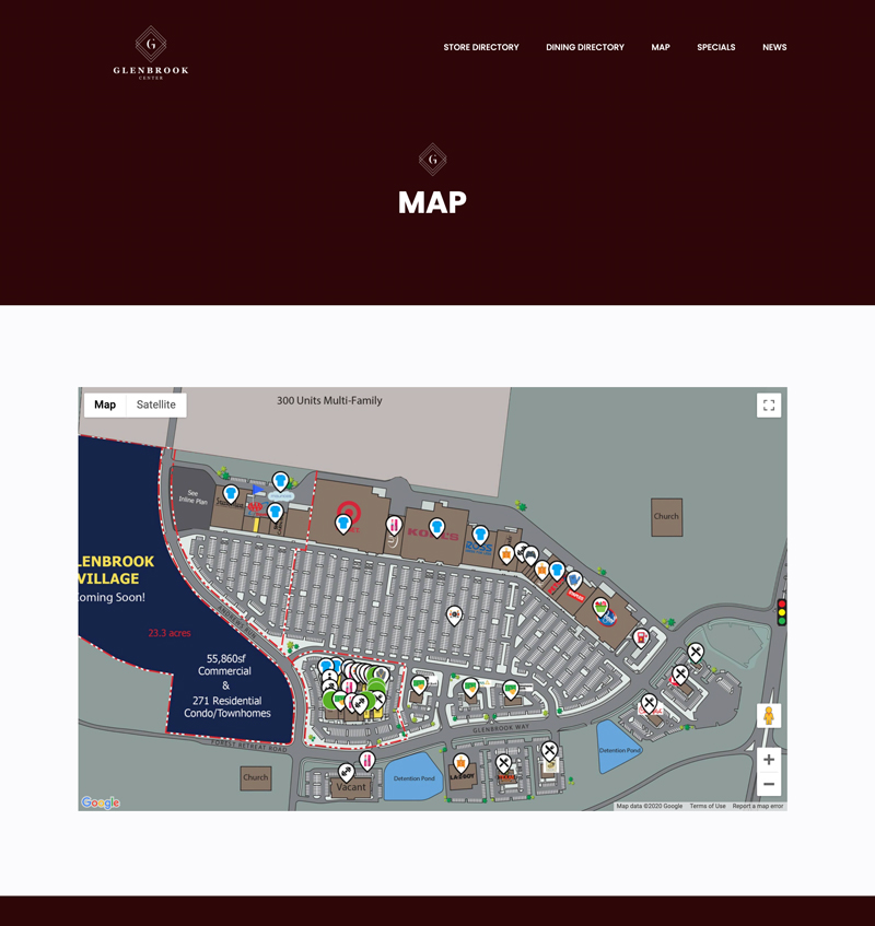
Industry examples
Connect fairground locations with food, exhibits, stages, and visitor services.
Explore fairsHelp fans move between stages, vendors, amenities, and scheduled performances.
Explore music festivalsMake rooms, booths, gathering places, and venue information easier to find.
Explore conferencesConnect attractions, local businesses, public art, and visitor information.
Explore tourismPlanning questions
Yes. An existing site, grounds, or venue graphic can be used when it meets the requirements for a supported illustrated map. Your team or Grandstand then configures the locations that make the artwork interactive; uploading an image alone does not make every illustrated element selectable.
An illustrated map uses a standalone site graphic as the visual guide. A supported geographic overlay places custom artwork on a geographic map foundation. The appropriate option depends on your space, artwork, package, and setup needs.
Supported map types can offer location search, categories, Show All and Hide All controls, custom pins, and map or list views. Exact controls vary by map type, package, and configuration.
Yes, supported locations can connect with vendor or place details and with relevant scheduled activities when those relationships are configured in the app.
Applicable packages and content types can support saved places or vendors and favorite filtering. A directions action can open supported directions for a location; it is not Grandstand-provided turn-by-turn navigation or accessible-route planning.
Yes, a configured app can offer multiple maps, such as an overview plus separate venue areas, decks, or floors. This is a map selector, not automatic floor detection, indoor positioning, or navigation between levels.
Availability depends on the map type and what the device has already downloaded. Some downloaded app content or illustrated map assets may remain available, while geographic map tiles, newly published information, external directions, and synced actions generally require a connection. GPS-based features also require location permission and may still depend on connectivity.
Pricing depends on the selected app package, map type, number and complexity of maps, supplied artwork, configured locations, and requested services. Custom artwork, geographic overlays, and setup assistance may involve additional fees; Grandstand can confirm the scope for your project.
Help visitors discover places, explore what’s nearby, and connect with the information they need.